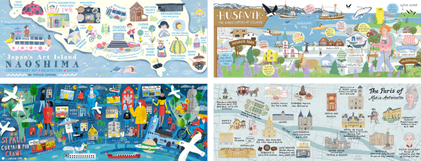
Stroly Inc, headquartered in Kyoto, is the developer and operator of an online map platform for illustrated maps that uses location information. To help promote its international launch in 2019, Stroly sponsored a contest with They Draw & Travel (theydrawandtravel.com), the world’s largest crowd-sourced illustrated map collection website.
The contest had a total of 317 entries from all over the world, the highest ever registered with a map contest of this kind, with a total of four grand prize winners announced on November 21, 2019.

Four grand prize winners
The title of the contest was “Mapping Special Places”, where the indication was to “create a map guide of a place that is very special to you”. Stroly joined forces with TDAT for the planning and launch of the contest, as well as being part of the panel of judges.
The four grand winners received cash prizes, and a total of 100 maps were included in the next release of an illustrated map book published by They Draw & Travel. All the maps in the book have been converted to Stroly Maps, and readers of the book will be able to scan a QR code to enjoy the maps with Stroly’s location information features right on their smart devices.
The book is currently available for purchase on Amazon. Two covers have been published: one available on Amazon International and one exclusive to Amazon Japan.
[Overview of the contest ‘Mapping Special Places’]
1.Contest details
The theme of the contest is ‘Create a map of a place that is very special to you’. A map introducing favorite places and recommendations, with navigational information and containing references to actual sites. This to make it possible to link it to GPS location information and can “actually walk on the illustrated maps” using Stroly’s platform.
2. Target area
All countries in the world
3. Submission period
Friday, October 11 to Sunday, November 17
4. Host and related organizations
Host: They Draw & Travel
Sponsor: Stroly Inc.
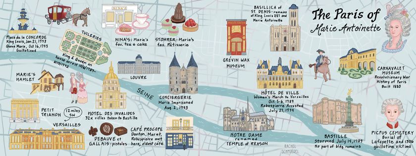
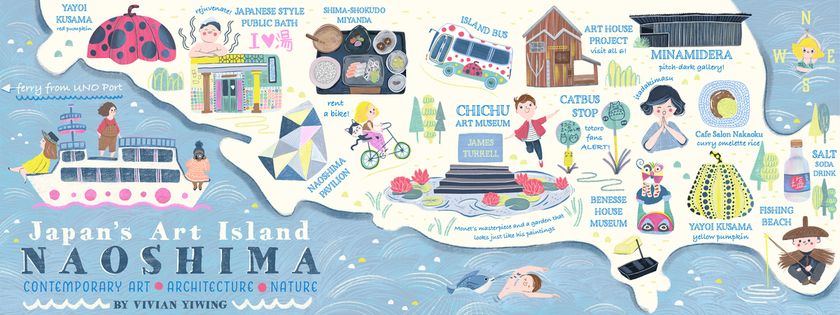
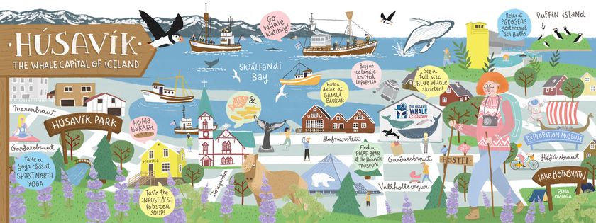
[Four grand prize winners]

The Paris of Marie Antoinette
“The Paris of Marie Antoinette” by Rachel Schmiedel (Delaware, USA)

St Pauli Curtain Pub Crawl
“St Pauli Curtain Pub Crawl” by Stephanie Hofmann (London, UK)

Naoshima: Japan’s Art Island
“Naoshima: Japan’s Art Island” by Vivian Yiwing (Vancouver, Canada)

Husavik, the Whale Capital of Iceland
“Husavik, the Whale Capital of Iceland” by Rena Ortega (Barcelona, Spain)
[References]
Illustrated map books previously published by TDAT
100 Illustrated Maps of American Places|They Draw & Travel
A dedicated page for the contest
https://www.theydrawandtravel.com/stroly-contest
Entries for the contest
https://www.theydrawandtravel.com/search/results?search%5Bconditions%5D%5Bregions%5D=Special+Places
●Stroly
Since February 2017, the launch of Stroly α version, Stroly developed and operates an online map platform that is widely used in Japan, Europe, the US, and throughout Asia.
With our motto of “share the way we see the world”, Stroly hires engineers, designers, and others with a variety of skills from many different countries, and develops products that are used globally.
●They Draw & Travel
A website with a collection of over 2,000 illustrated maps created by artists from around the world. It was founded in 2011 by professional illustrators Nate Padavick and Salli S. Swindell. With his experience in designing illustrations for message cards, magazines, and books, he plans and operates the website where the world’s largest illustrated maps are gathered.
—
[See below regarding press inquiries or interview requests]
Stroly, Inc.
109-1 Kanegaecho, Shimogyo, Kyoto, Japan 600-8258
URL: http://stroly.jp
Company representative: Machi Takahashi, Founder, Co-CEO
Media Contact:
Nao Myoshu
Stroly Inc.
info@stroly.jp
